


RACE SAFETY and DETAILS from the Director of stoke, Bobby wintle.
ATTENTION ALL CYCLISTS!
The Half Marathon and 50k Ultra Marathon course is completely off-limits to cyclists during the running events on Friday from 6 a.m. until DFL comes home. Do not ride on the 50k or Half course during Friday as a pre-ride. Below are links for many other fantastic routes that do not intersect with the running course. This has been a major problem in the past and we want the runners to be safe first and foremost and we want them to have every ability to focus on their event without tons of cycling traffic. If you would like to ride out and see the runners on course below is a route that will take you to mile 20 at the start of Bovine Bypass the private land where the 50k runner, 50 mile, and 100 mile cycling routes will be traversing. This route is mostly pavement leaving downtown Stillwater but will be completely clear of the running courses. PLEASE DO NOT PRE-RIDE the private land section at any time outside of the cycling events on Saturday March 14th. You can meet runners here to cheer them on at the aid station but you cannot ride the course. If you are found on any part of the running course through the running events all day on Friday March 13th you will be subject to disqualification from the race on Saturday March 14th. We know this is harsh but we must ensure the safety of all the runners. Thank you for understanding. Thank you so much for your help with keeping the running course clear.
Rail Road crossings! The 100 mile course will cross live and active rail road crossings at mile 28.2 leaving Mulhall aid station and again at mile 38.4. Please do not take chances. These crossings are live and very busy and unpredictable. Do not shoot the gap. Do not try and beat the train. These crossings do not have arms that lower so you must slow down and look before crossing. Be safe and get home to us. Thank you.
Highway Crossing of HWY 77 is at mile 39.7 on the 100 mile course. Traffic does not stop on the hwy. Please be as cautious as possible here. The last hwy crossing on the 100 mile course is at mile 84.2 across hwy 33. This is a busy highway and cross traffic does not stop here. Please be aware and do not take chances.
HWY 33 Bridge Construction: All cyclists on the 100 mile course will have full permission to use the brand new bridge across the Cimarron River at mile 82.1. The bridge is under construction and there is a 2ft ridge when turning onto the beginning of the bridge. This is a mandatory dismount section for all Pro and 100 mile cyclists. This bridge is not open to any vehicles including our Jeep SAG or any support vehicles or public. When you come to this right turn you will have full private access to the entire brand new bridge across the Cimarron. It's kind of like the biggest and most beautiful bike path you've ever seen. Enjoy it!
ATTENTION ALL RUNNERS!
Half Marathon: All half marathon runners will get to mile 6.6 on the route and have a designated turn around spot to begin the 2nd half of the run back to downtown Stillwater. This route is an out and back and will hit an aid station at mile 4.5 and mile 8.5 on the way back to the finish!
50K Ultra: IMPORTANT! Support crews are ONLY allowed to meet you at the start of the Bovine Bypass private land section at mile 20.7. In the past we have had crews meet at the halfway aid station close to mile 15 but we have made the change to allow for better access for vehicles and parking at the mile 20 Aid station number 4. Please relay this information to your support crews ahead of time and share the route below for vehicles to drive from downtown Stillwater to the aid station. The route will keep vehicles off the running course routes completely until they hit the aid station. No support crews are allowed on the course at any other mile marker or aid station and runner's will be subject to disqualification if caught taking aid at any other point outside of mile 20.7 at Aid #4.
ATTENTION PRO ATHLETES
The Pro 100 mile course differs just slightly from the Amateur 100 mile course. The aid station for all Pro's will be at mile 52.4 at Dunagan Farms 8747 Co Rd 74, Guthrie, OK 73044. All support crews can park at the property on the North side of the road at the farm. We will have water and limited nutrition for those pros without a support crew. Please communicate to your crews that there can be absolutely NO CONTACT with you or other riders for any mechanical or nutritional aid of any kind outside of this aid station. You will be disqualified if you recieve aid at any other spot on course outside of Dunagan Farms at mile 52.4.
PRO 100 & PRO DOUBLE Check in: Thursday 3/12 3pm-6pm / Friday 3/13 6am-7am & 12pm-Start at the Simmons Bank Pavilion at Block 34 next to start/finish line
PRO MENS START (including PRO DOUBLE MEN) 1pm FRI 3/13
PRO WOMEN START (including PRO DOUBLE WOMEN) 1:15pm FRI 3/13
PRO NON-BINARY START (including PRO NON-BINARY DOUBLE) 1:30pm FRI 3/13
AID STATIONS: Support crews can ONLY meet you at mile 52.4 at Dunagan Farms. Neutral water and port-a-pottys will be availalbe at mile 28 in Mulhull, OK and at mile 95.8, but no support crews are allowed to meet you there on race day.
PRO DOUBLE TRANSITION AREA: Pro Double participants will be able to stage their bike, clothes, and gear at an enclosed area on 8th and Husband.
PRO DOUBLE TIMELINE: If you are registered for the Pro Double and do not finish your 50K run by the start of the 100 mile cycling event, you will be marked as a DNF
PRO PODIUMS: All Pro category podiums will be at the Main Stage at Block 34 directly after the final PRO top 3 finishes. The Main Stage welcome meeting is scheduled for 6-7 p.m. Friday evening and weather dependent, the pro podium finish is tentatively scheduled during that time.
(un) Known Factors
There is no escaping it, the weather plays an unmistakable role in how The Mid South plays out every year.
Hoping to understand our weather patterns a little more, we invited our friend Ron Elliott to bring some context. Ron is a co-founder of the Oklahoma Mesonet and we’ve asked him to share some interesting weather insights on the specific area you’ll be riding and running. The Oklahoma Mesonet is a network of 120 weather and soil monitoring stations located across Oklahoma. At each site, sensors collect comprehensive data that are transmitted to a central facility every 5 minutes, 24 hours per day, year-round. In just a few minutes, the measurements acquired are available to the public. The Oklahoma Mesonet serves as a model for those seeking to observe the earth and atmosphere and is recognized as the “gold standard” in real-time weather networks. If you want the richest and most current weather data including air temperature, wind speed and direction, rainfall, and even National Weather Service radar, you can download the free Oklahoma Mesonet apps for Apple and Android. The app offers realtime, granular data that can be appreciated by weather scientists and endurance athletes alike.

OKLAHOMA SKY
Talk of Oklahoma weather is often done in the extremes. It’s not always the most predictable place to ride or run. Here in Payne Co. we’ve recorded a low of -19 F and a high of 117F. Across the state the Mesonet has recorded wind gusts of 151 mph and a whopping one hour temperature swing from 74F to 34F. It can be tough to choose layers properly for that kind of temperature variation. But unless you’re looking to move to Oklahoma, you are probably most concerned with the weather conditions right around mid March. Let’s take a look at Mid South weekends of the past to get a better idea of what we may be encountering.
image: Cycling Tips
Rainfall

Oklahoma Dirt
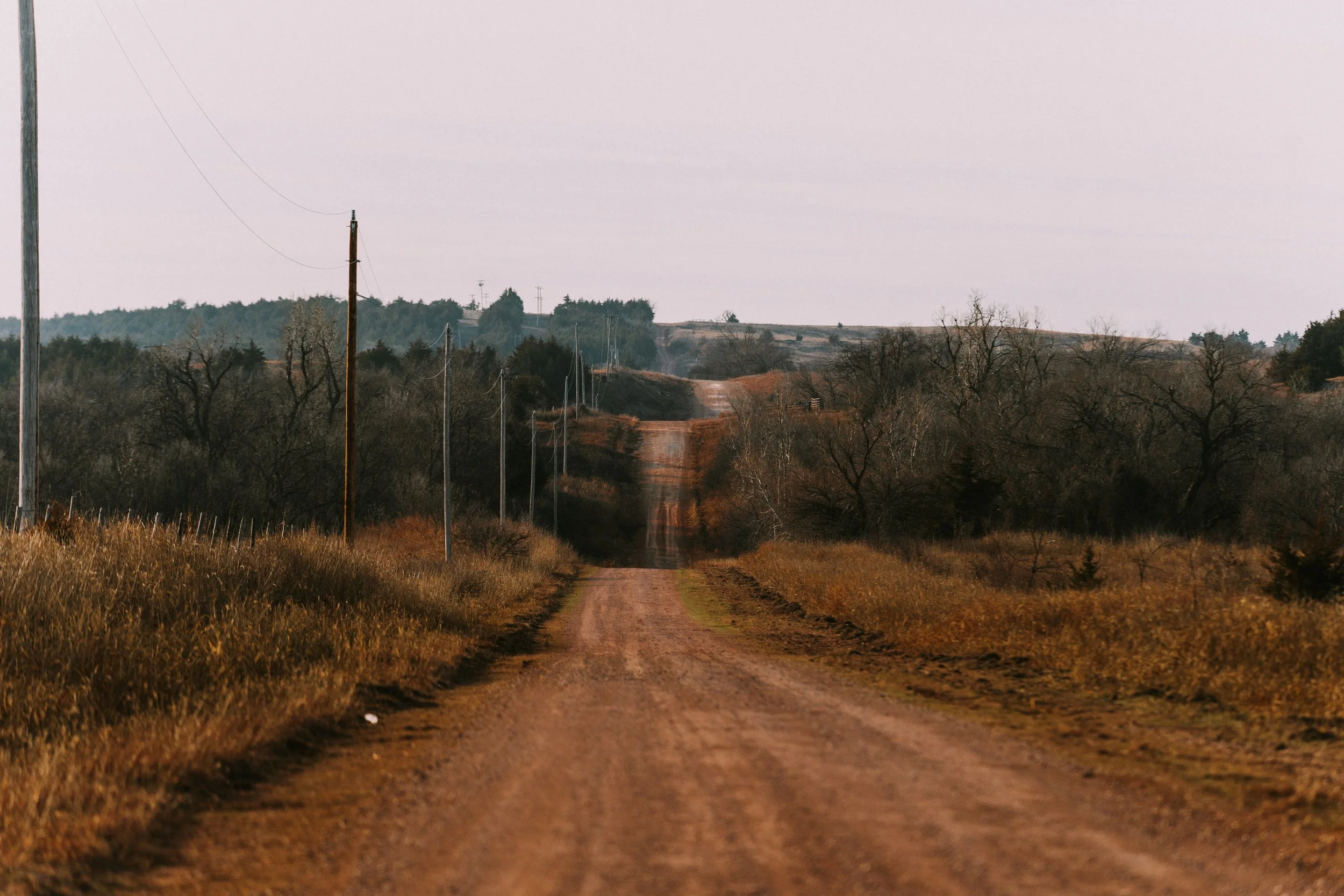
Riding and running in wet weather is a little different here. If this is your first time to Oklahoma you’ve no doubt noticed some red dirt already.
For the local gravel riding and running community, the term red dirt brings up images of beautiful country roads that, with the right amount of rain, can transform from fast, hard-packed surfaces into gooey and sticky “peanut butter mud.” When it’s wet and cold, we can descend into downright uncomfortable conditions. These factors combine to make for an event day that can be a true test to finish!
photo : 241 Photography
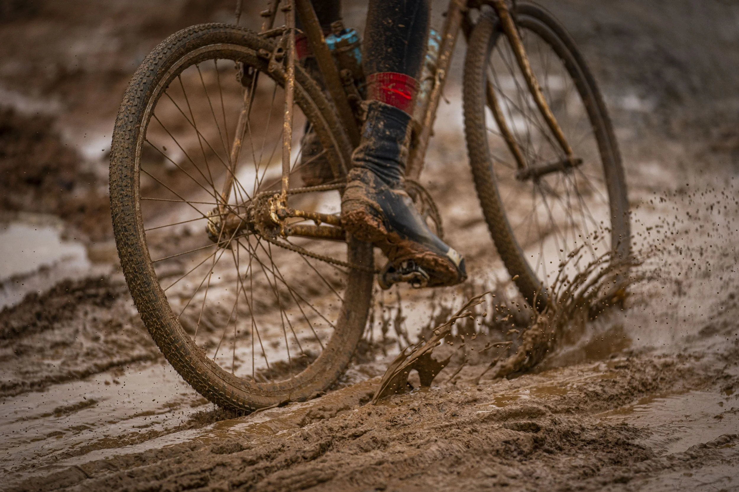
Soil types vary considerably across Payne County and are determined by the percentages of sand, silt, and clay particles making up the soils. In the area around Stillwater, the surface soil generally tends to be loam to silt loam in texture, with a reddish color.
That color is due to the presence of iron oxide (i.e., “rust”).
Below the surface, there is usually a soil layer with a higher percentage of clay particles.
Soils with higher clay content tend to have:
lower infiltration rates during rainfall (leading to greater surface runoff)
higher water holding capacities
Much more “stickiness” when wet,
Slower rates of drainage/drying.
photo : Andy Chasteen
wind and temp data

How to prepare
Oklahoma weather can be highly variable, especially this time of year so be prepared in terms of clothing and equipment. Waterproof outerwear, gloves, shoes or shoe covers are a good idea.
If there is rainfall during event lead up, be prepared for some tough sections on the course. Even light rain can lead to wheel stopping mud buildup. Smart equipment choices like proper layering, tire selection, and a handy mud stick can make a big difference but in the end, it all comes down to your will to cross the finish line.